Outdoors
Grand Canyon South Kaibab Hike
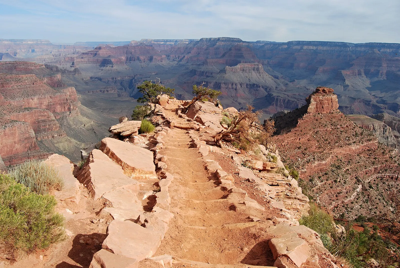
You walk down a steep, exposed trail from the rim near Yaki Point to Ooh Aah Point, where the trail opens to a wide view (there is no sign), then on to Cedar Ridge before climbing back to the rim. The trail is well-maintained dirt with very little shade.
- Where
- Arizona, USA
- Distance
- 4.8 km (3 miles) return to Cedar Ridge; 2.9 km (1.8 miles) return to Ooh Aah Point
- Climb
- 340 m (1,120 ft) of elevation change to Cedar Ridge; 230 m (790 ft) to Ooh Aah Point
- Time
- 2-4 hours to Cedar Ridge; 1-2 hours to Ooh Aah Point
The route
South Kaibab Trail from the South Rim to Cedar Ridge via Ooh Aah Point, and back.
The trailhead is on Yaki Point Road on the South Rim, at 2,213 m (7,260 ft). There is no public parking and no private vehicles are allowed, so park at the Grand Canyon Visitor Center and take the Kaibab Rim (Orange) Route shuttle, or the early-morning Hiker's Express.
When to go
Open all year, but the upper trail can be extremely icy in winter and early spring, and in summer the open trail gets extreme heat; the park says not to go past Cedar Ridge as a summer day hike.
Permits and fees
Entrance costs $35 per vehicle or $20 per person on foot or bike, valid for 7 days, and in 2026 non-US residents aged 16 or over pay an extra $100 each unless they hold an annual or America the Beautiful pass. The trailhead is reached only by the free park shuttle, on foot or by bike.
Before you go
- Carry all your water: there is none on the trail, and the park has reported the trailhead water station switched off because of a pipeline break.
- Plan on taking twice as long to climb back up as it took to walk down; the steepness is easy to underestimate on the way down.
- Cedar Ridge has toilets and is the park's suggested turnaround for first-time canyon hikers, casual hikers and late starters.
- If you meet mules, step off on the uphill side away from the edge, stay quiet and still, and wait until the last mule is 15 m (50 ft) past you.
What to bring
- Shoes with grip that you have already worn in
- At least 1.5 litres of water
- Food you will actually want to eat
- A warm or waterproof layer
- The route, saved offline
- Sun cream and a hat
Getting ready for it
If your longest walk lately is under two hours, do a few longer walks first, ideally with some climbing and the pack you will carry.
Step-ups and lunges twice a week make the descents much easier on your knees.
Staying safe
- Summer heat on this exposed trail can be life-threatening; do not try to hike to the river and back in one day, especially from May to September.
- The upper section can be extremely icy in winter and early spring.
- Tell someone your route and when you expect to be back.
- Turn around if the weather turns or the footing gets sketchy. The trail will still be there.
Route details checked September 30, 2026 against nps.gov, nps.gov, nps.gov, nps.gov and nps.gov. Rules and closures change, so check before you go.