Outdoors
Basaseachi Falls Trail Hike
The Arroyo Durazno and Arroyo Basaseachi join and drop 246 m into the canyon. An easy 15-minute path leads to the falls, and from there the Canyon Floor Trail descends through steep, demanding sections to the base, where the Río Candameña begins.
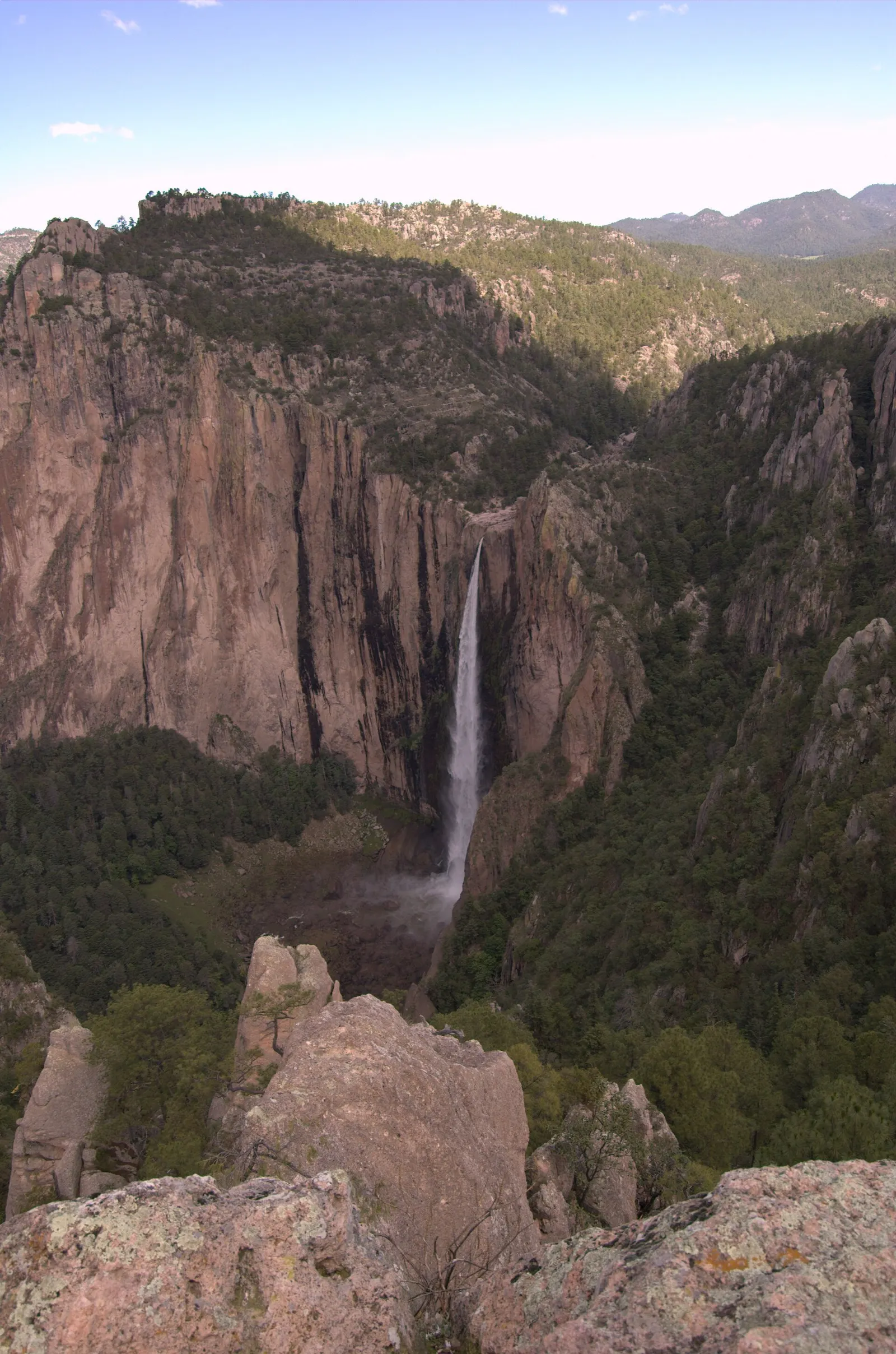
- Where
- Chihuahua, Mexico
- Time
- at least 2.5 hours return
The route
Canyon Floor Trail to the base of the Cascada de Basaseachi, Parque Nacional Cascada de Basaseachi.
The park is a few kilometres from the village of Basaseachi, about 265-290 km west of Chihuahua city on Federal Highway 16 towards Hermosillo; turn off at Las Estrellas. You can arrive by private vehicle, bus or with a tour operator.
When to go
The falls carry most water in the rainy season, June to September, and CONANP recommends visiting in summer.
Permits and fees
CONANP charges MXN 125 per person per day (50% off for Mexican nationals and residents, 75% off for students and teachers, free for under-12s and seniors). Hours are 8:00-17:00, extended to 19:00 in summer.
Before you go
- The trails are well marked and can be walked without a guide.
- For more, the San Lorenzo Trail climbs to several overlooks on the canyon rim; allow at least 2 hours.
- Camp only in the park campground, and light fires only in the set areas.
- Creel is the nearest town with a good range of hotels and restaurants.
What to bring
- Shoes with grip that you have already worn in
- At least 1.5 litres of water
- Food you will actually want to eat
- A warm or waterproof layer
- The route, saved offline
- Sun cream and a hat
Getting ready for it
If your longest walk lately is under two hours, do a few longer walks first, ideally with some climbing and the pack you will carry.
Step-ups and lunges twice a week make the descents much easier on your knees.
Staying safe
- The descent to the base has several steep, demanding sections, and you have to climb all of it back out.
- Tell someone your route and when you expect to be back.
- Turn around if the weather turns or the footing gets sketchy. The trail will still be there.
Route details checked September 30, 2026 against descubreanp.conanp.gob.mx, en.wikivoyage.org, en.wikipedia.org, es.wikipedia.org and mexicodesconocido.com.mx. Rules and closures change, so check before you go.