
Outdoors
Tiger's Nest Trail Hike
You climb a mule track through pine forest to a cafeteria viewpoint facing the monastery, then continue to Taktsang, which sits on a cliff at 3,120 m, about 900 m above the Paro valley. The last part crosses a bridge by a 60 m waterfall below the main buildings.
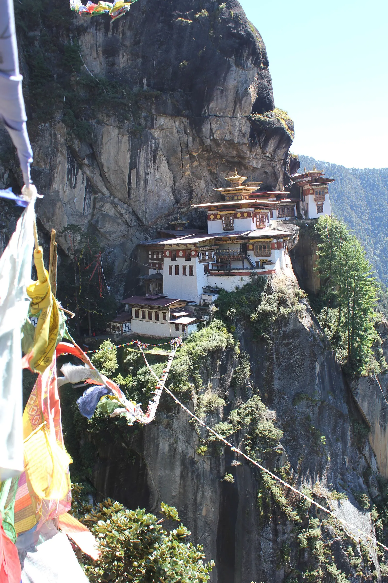
- Where
- Paro, Bhutan
- Time
- 2-3 hours up; allow extra for the descent and your visit
The route
Paro Taktsang (Tiger's Nest) trail from the car park below the monastery.
The trail starts from a car park at the base of the mountain, about 10 km north of Paro. You will travel there with your guide.
When to go
Bhutan's tourism department says autumn (late September to late November) brings bright, sunny days and spring (March to mid-April) is generally dry; the summer monsoon runs from late June or July to late September, mostly affecting the south.
Permits and fees
You need a Bhutan visa (a one-off US$40 fee) and must pay the Sustainable Development Fee of US$100 per adult per night (US$50 for ages 6 to 11). A Department of Tourism certified guide must be with you at all times, including to enter monuments. The monastery also charges an entry fee.
Before you go
- Buy your monastery ticket before you set off; Wikivoyage reports the ticket office at the car park closes at 13:00 and that tickets are checked at the gate.
- Start early: the monastery is open 08:00 to 16:00, according to Wikivoyage.
- The cafeteria at the viewpoint, about 90 minutes up, is the natural place for a break.
- Wear clothing that covers your shoulders and knees for the monastery visit.
What to bring
- Shoes with grip that you have already worn in
- At least 1.5 litres of water
- Food you will actually want to eat
- A warm or waterproof layer
- The route, saved offline
- Sun cream and a hat
Getting ready for it
If your longest walk lately is under two hours, do a few longer walks first, ideally with some climbing and the pack you will carry.
Step-ups and lunges twice a week make the descents much easier on your knees.
Staying safe
- The monastery is at 3,120 m, so you may feel the altitude on the climb.
- The path runs close to steep drops near the monastery.
- Tell someone your route and when you expect to be back.
- Turn around if the weather turns or the footing gets sketchy. The trail will still be there.
Route details checked September 30, 2026 against bhutan.travel, en.wikipedia.org and en.wikivoyage.org. Rules and closures change, so check before you go.
_(15658140647).jpg)