Outdoors
Bryce Canyon Navajo Loop Hike
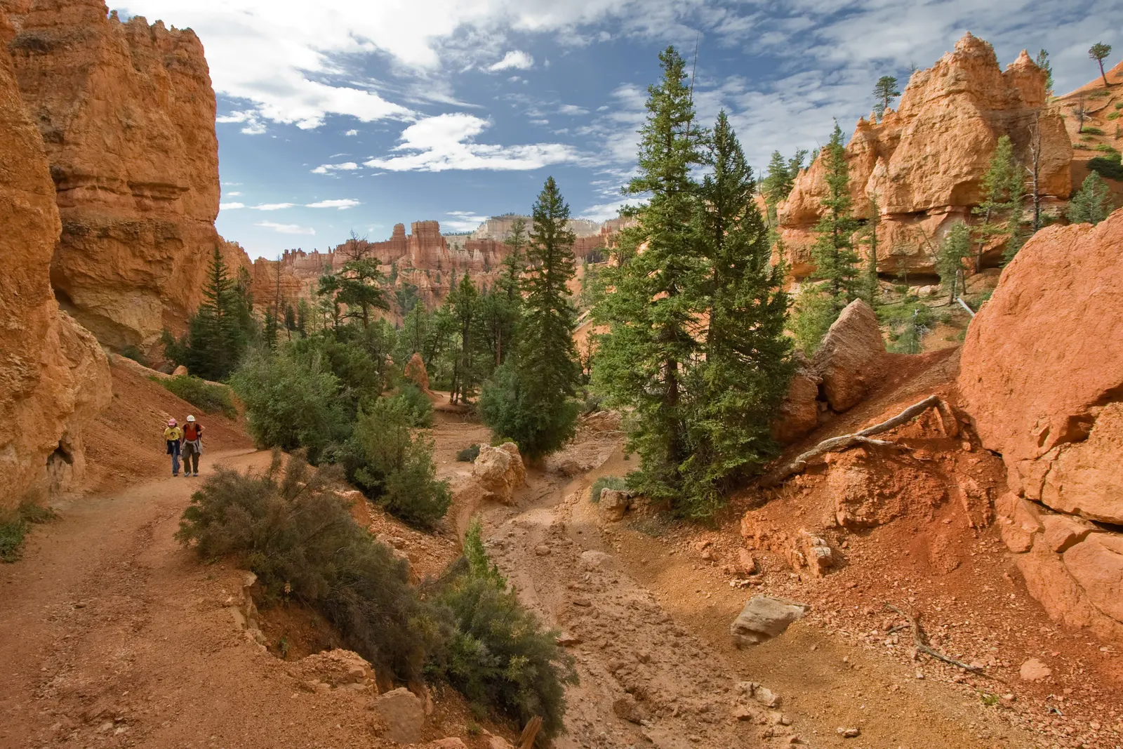
You descend switchbacks below Sunset Point between narrow walls of coloured limestone and tall Douglas firs, passing Thor's Hammer, then climb back to the rim. The Wall Street side has the famous switchbacks; the Two Bridges side is the other half of the loop.
- Where
- Utah, USA
- Distance
- 2.1 km (1.3 miles) loop
- Climb
- 157 m (515 ft)
- Time
- 1-2 hours
- Difficulty
- Moderate
The route
Navajo Loop from Sunset Point (Wall Street and Two Bridges sides).
The loop starts and ends at Sunset Point on the main park road. In season, the free park shuttle stops at Sunset Point; the park suggests parking at the Shuttle Station in Bryce Canyon City or the extra lot opposite the visitor centre.
When to go
The Two Bridges side is open all year, but the Wall Street side closes in winter; in winter you can walk the Two Bridges side as an out-and-back.
Permits and fees
Entrance costs $35 per vehicle or $20 per person for 7 days, and in 2026 non-US residents aged 16 or over pay an extra $100 each unless they hold an annual or America the Beautiful pass. The shuttle is free with park admission and runs from 3 April to 18 October in 2026.
Before you go
- Combine it with the Queen's Garden Trail for a 4.7 km (2.9 mile) walk.
- Fill water bottles at Sunset Point: there are seasonal filling stations and a year-round tap at the Sunset Point toilets.
- Pets are not allowed on this trail.
- Shuttle hours in 2026 are 8 am to 8 pm from 9 May to 20 September, and 8 am to 6 pm in the shoulder weeks.
What to bring
- Shoes with grip that you have already worn in
- At least 1.5 litres of water
- Food you will actually want to eat
- A warm or waterproof layer
- The route, saved offline
- Sun cream and a hat
Getting ready for it
If your longest walk lately is under two hours, do a few longer walks first, ideally with some climbing and the pack you will carry.
Step-ups and lunges twice a week make the descents much easier on your knees.
Staying safe
- Tell someone your route and when you expect to be back.
- Turn around if the weather turns or the footing gets sketchy. The trail will still be there.
Route details checked September 30, 2026 against nps.gov, nps.gov, nps.gov and nps.gov. Rules and closures change, so check before you go.