Outdoors
Olympic Hurricane Hill Hike
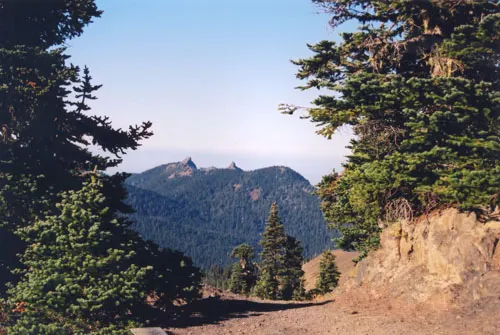
A paved path climbs from Hurricane Ridge to the top of Hurricane Hill, with 360-degree views in clear weather over the mountains, Vancouver Island and the Strait of Juan de Fuca. The first stretch is gentle, but most of the rest is steep, at grades of 10-18%.
- Where
- Washington, USA
- Distance
- About 4.8-5.1 km (3-3.2 miles) return
- Climb
- About 197-213 m (645-700 ft)
- Difficulty
- Hard
The route
Hurricane Hill Trail from the end of Hurricane Hill Road to the summit and back.
The trailhead is at the end of Hurricane Hill Road, beyond the main Hurricane Ridge parking area, with a small car park opposite the trailhead and overflow parking at Picnic Area B.
When to go
Hurricane Ridge Road is open throughout summer; in winter it is scheduled to open only Friday to Sunday and on holiday Mondays, weather permitting, and 9-11 m (30-35 ft) of snow a year can linger into summer.
Permits and fees
Entrance costs $30 per vehicle or $15 per person for 7 days. No reservation or timed entry is mentioned for Hurricane Ridge.
Before you go
- The trail starts by dropping gently for about 120 m (400 ft); after about 750-820 m (2,450-2,700 ft) it becomes steep, and the park suggests that point as a good place to consider turning back.
- Pets are not allowed on the trails, and the park asks you not to feed wildlife and to keep your distance.
- In winter you must carry tyre chains on Hurricane Ridge Road; check the road status line on 360-565-3131 before driving up.
- Stay on the paved trail or on snow to protect the meadows.
What to bring
- Shoes with grip that you have already worn in
- At least 1.5 litres of water
- Food you will actually want to eat
- A warm or waterproof layer
- The route, saved offline
- Sun cream and a hat
Getting ready for it
If your longest walk lately is under two hours, do a few longer walks first, ideally with some climbing and the pack you will carry.
Step-ups and lunges twice a week make the descents much easier on your knees.
Staying safe
- Wind gusts over 120 km/h (75 mph) can hit the ridge, and the weather can close the road at any time.
- Tell someone your route and when you expect to be back.
- Turn around if the weather turns or the footing gets sketchy. The trail will still be there.
Route details checked September 30, 2026 against nps.gov, nps.gov, nps.gov, nps.gov and nps.gov. Rules and closures change, so check before you go.